CBRN SAED Early Warning System (EWS) is a method and system in order to locate a target and represent it location on a GIS** environment (a registered patent).
CBRN SAED is a fully C4ISR system, giving the ability to remotely control and monitoring targets in real time.
** Geographical Information System
‘3 Level Security Bulgaria’ ltd R&D section finalize the first phase of ‘HERACLES’. At its finale stage ‘HERACLES’ will be an ultimate Early Warning System for incoming *C.B.R.N. (Chemical, Biological, Radiological, Nuclear) threats in a wide area over 100km diameter.
The purpose of the ‘HERACLES’ development is the provision to the competent Commander / Director / Governor of timely information regarding the existence or entry of C.B.R.N. threats (targets) in its area of responsibility. Client – server is the architecture of the system and the technological level of ‘HERACLES’ is 'C4ISR' (Command Control Computers Communication Intelligence Sensor Recognizance).
We are looking for strategic investors to participate in this project AS TO KEEP EUROPE SAFE and FREE from any C.B.R.N. incoming threat.
The prototype system we develop as far (version 1) consists of 4 subsystems as follows:
1. Threats (targets) DETECTION Subsystem. A portable, manual handled detector (device) that detects material structures from over 1000 meters depending of the mass of the targets and in great depths inside the ground or water. Today the system successfully detects hazardous nitrogenous chemicals containing 75% such as the chemical substance 2,4,6-trinitrotoluene, C6H2(NO2)3CH3 (T.NT. high power military explosive matter).
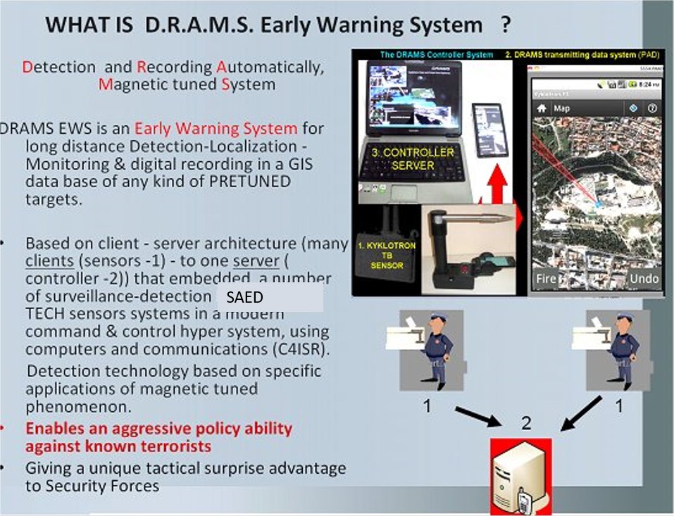
2. Targets (C.B.R.N. threats) Identification and Recording Subsystem. An application - software running on ANDROID platform, running on a smart phone or a P.A.D. or other device that uses magnetic sensors and GPS. The application uses offline digital maps with a GIS database. It shows in real time the position of the detector and the direction of the target that the detector shows in the horizontal level. At the STAND ALONE process the operator using the triangulation method the application automatically shows the distance of the target, and its coordinates, which automatically record in the GIS database. Operating the client-server architecture model in real time, this application has the ability to function as a client, sending in real time operators position and target direction to a server.
3. Target identifying and recording sub-system. Supporting tools (tripods, LASER, etc) for accurately target localization.
4. Digital Monitoring System for two or more DETECTORS operators and real time target monitoring. This is the server part at the client – server model of ‘HERCULES’. This application used for Identification and Recording threats, in case of use 2 or more detectors. The application – subsystem accept and display on screen, in real time, the position of the operators (over 10) and the direction of the C.B.R.N. threats (targets) (over 10) that the operators detect. The application runs on a stable or portable computer or PAD and uses offline GIS digital maps. The system IMMEDIATELY locate and monitor the threat or threats by 2 or more detectors, working at a distance from each other. Also eliminates the need to move the operators to another, second location in order to locate the target.
The developed prototype system is an application of the patent number GR1005224, 2040100482 of the Industrial Property Organization (list number:16) and has been approved by the Greek Armed Forces General Stuff in 2007 by this written order File 900 / 32/121610 / Draft 335 /Mar 6, 2007/Hellenic Armed Forces General Staff /Research & Informatics Section (E).
THE 'CBRN SAED' FOR C.B.R.N. THREATS EARLY WARNING SYSTEM DEVELOPMENT PLAN
THE 'CBRN SAED' EARLY WARNING SOLUTION FOR CBRN THREATS CONFRONTATION
THE 'CBRN SAED' MODELS FOR SECURING EUROPEAN UNION FROM C.B.R.N. THREATS
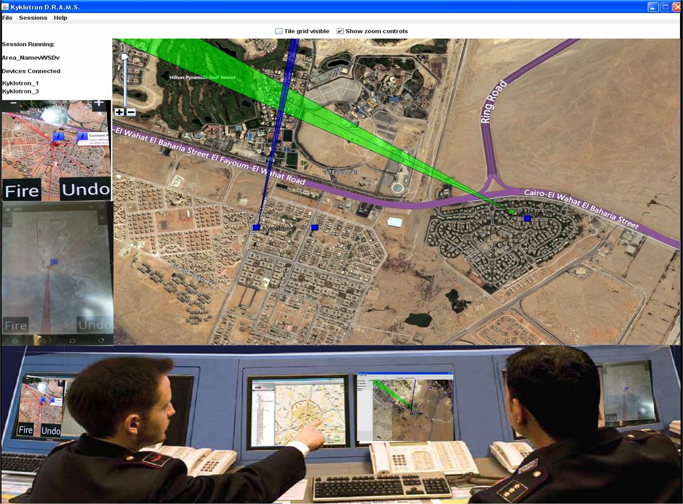
By the use of 'CBRN SAED', an '3 Level security' Ltd registered patent GR20070100067/2008-09-19 method, targets located and represented on a Geographical Information System environment. 'CBRN SAED' is a fully C4ISR system, giving to chief of operations the ability to remotely control and monitoring operations in real time and could:
· Clean an area (city – railway station – port – airport – bus station – building – camp etc) from C.B.R.N. threats .
· Protect an area 24 hours a day (city – railway station – port – airport – bus station – building – camp etc) from C.B.R.N. threats .
· Search, Detect and Localize commercial or non-commercial (hand-made) C.B.R.N. threats, any Trap that embedded C.B.R.N. threats in ground, on a range over 20000 meters, or even underground and deep into the water or sea.
In current international enterprises world, world marketing, open borders and free locomotion's, the challenge of remotely finding and localization of any distinguishable material C.B.R.N. structure from long distance is more powerful and more awkward than ever. The ability to find material structures as C.B.R.N. threats is now a reality.

the 'CBRN SAED' Early Warning System equipment (VERSION 1.0)
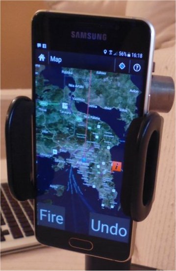
the SAED CBRN Support system (an ANDROID O.S. Application running on a smart phone, TAB or else)
This system has integrated elements to be magnetic tuned with every pre - tuned material structure as any C.B.R.N. threat. By using the magnetic tuned phenomenon for tuned materials with a high sensitivity, the ‘CBRN SAED' system can detect from short distances 0 - 500 meters every pre - tuned material. It makes the device able to ignore any known attempts to disguise the substance or target or hiding and identification of that substance or substances. In ideal conditions range reach over 6.000 m for amounts about 10 kg of a material kind of C.B.R.N. threat. The detection range always DEPENDING from MASS and DISTANCE of the target.
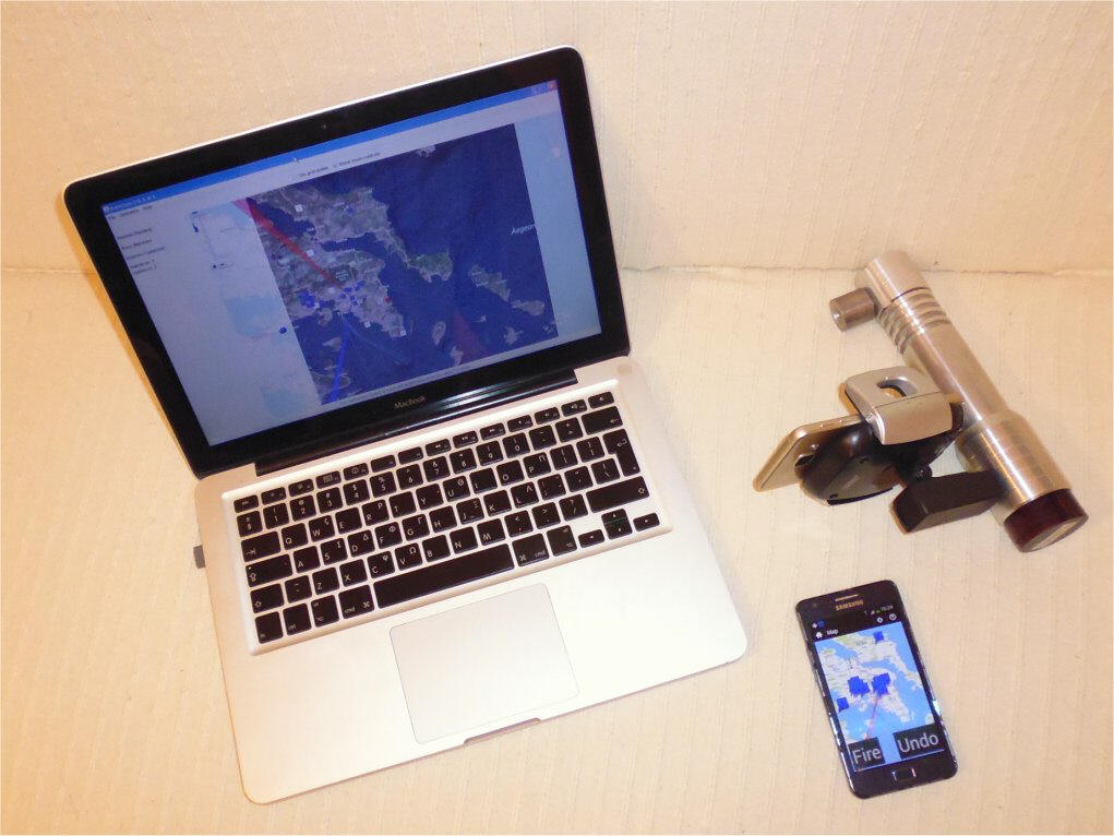
'CBRN SAED' SPINOTRON DETECTION system

'CBRN SAED' ENDR DETECTION system
‘CBRN SAED’ system detects C.B.R.N. threats in open terrain, behind walls, barriers, buildings, hills, inside vehicles and metal containers, etc.
‘CBRN SAED’ system is a system that can be used at Operations Level.
3 Level Security ltd advanced ‘CBRN SAED’ technology is the only system that exists today that accurately detects C.B.R.N. threats in long distances > 6.000 meters.
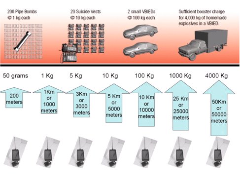
DETECTION RANGE according to TARGET MASS for SPINOTRON systems

SCREEN VI from the SUPPORT SYSTEM for SPINOTRON / MAGNOTRON / WMTS & ENDR systems
Detection using the 'CBRN SAED' method
what is 'CBRN SAED' ? (Detection and Recording Automatically by a Magnetic tuned System)
'CBRN SAED' is an operational (strategic or tactical) system (using two or more users mobile, immobile or combination, shown as yellow and blue humans on the next pictures) detecting and electronically recording on a smart phone the precise specific localisation of distinguishable C.B.R.N. threats from long distance (over 20.000 meters). The exact point (shown as a blue circle on the next picture) of located C.B.R.N. threats on the ground or surface of sea, in real time recorded in a digital geographic background (GIS) data base, on ‘CBRN SAED’ smart phone screen (shown as the cross of two or more lines on next pictures).
'CBRN SAED' makes the invisible follow-up and by distance digital recording of various terrorism teams and enemies moves possible
The use of 'CBRN SAED' can solve most nowadays serious problems as that of automatic recording of C.B.R.N. threats.


One , two, three or more ‘CBRN SAED’ systems (1, 2, 3 or more users mobile – immobile (on foot) or combination mobile and immobile users) scanning a territory
searching for distinguishable C.B.R.N. threats from long distance (over 20.000 meters). As an example see next pictures. x1, x2, x3 are 3 users scanning using 'CBRN SAED' . system the area to be protected (included in the 4 red lines). x1, x2, x3 users scanning continuously inside the protected area (included in red lines).

The direction each user (X1, x2, x3 ) pointing by the Magnetic Tuned Receptor of ‘CBRN SAED’ systems writing as a color line on a territory digital map in 'CBRN SAED' computer (smart phone).
X1, x2, x3 users can not see other users Magnetic Tuned Receptor direction ( this means that Magnetic Tuned Receptor attracted from one target, C.B.R.N. threats as an example) , but a super user – 'CBRN SAED' controller - can see every Magnetic Tuned Receptor direction and 'CBRN SAED' system users on his computer screen, on a digital map.
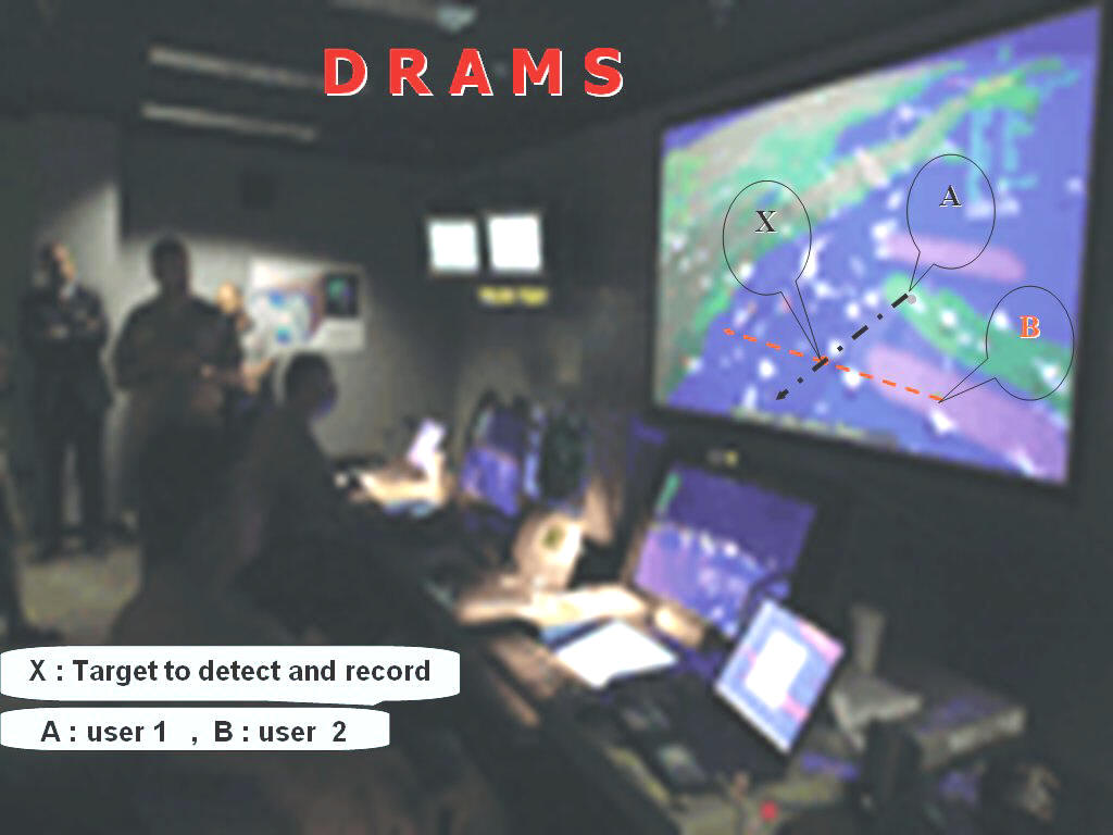
This because a,b,c,d users 'CBRN SAED' systems are connected in a 3G VPN (or other tech) communication network. Every user knows what himself and the other users searching. In every user computer screen appeared the point that he stands and the line that his system Magnetic Tuned Receptor points.
The exact point of located explosive on the ground or surface of sea in real time recorded in the Geographical Information System (GIS) data base on 'CBRN SAED' system smart phone.
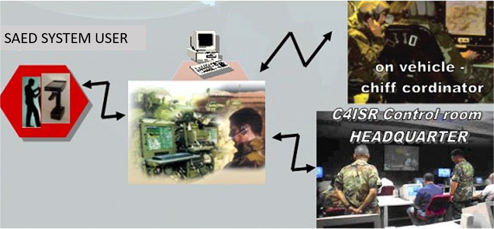
A typical down to top 'CBRN SAED' module & hierarchy (user ->controller ->coordinator)
The same icon could transmitted by a common 3/4/5 G (or any other communication system private or military or common) network to any other computer installed in a command and control center, or at any other computer existing in a vehicle, or a mobile command and control center. This real time, tactical picture, can easily represent on a big screen of a command and control center , making 'CBRN SAED' a full C4ISR system.
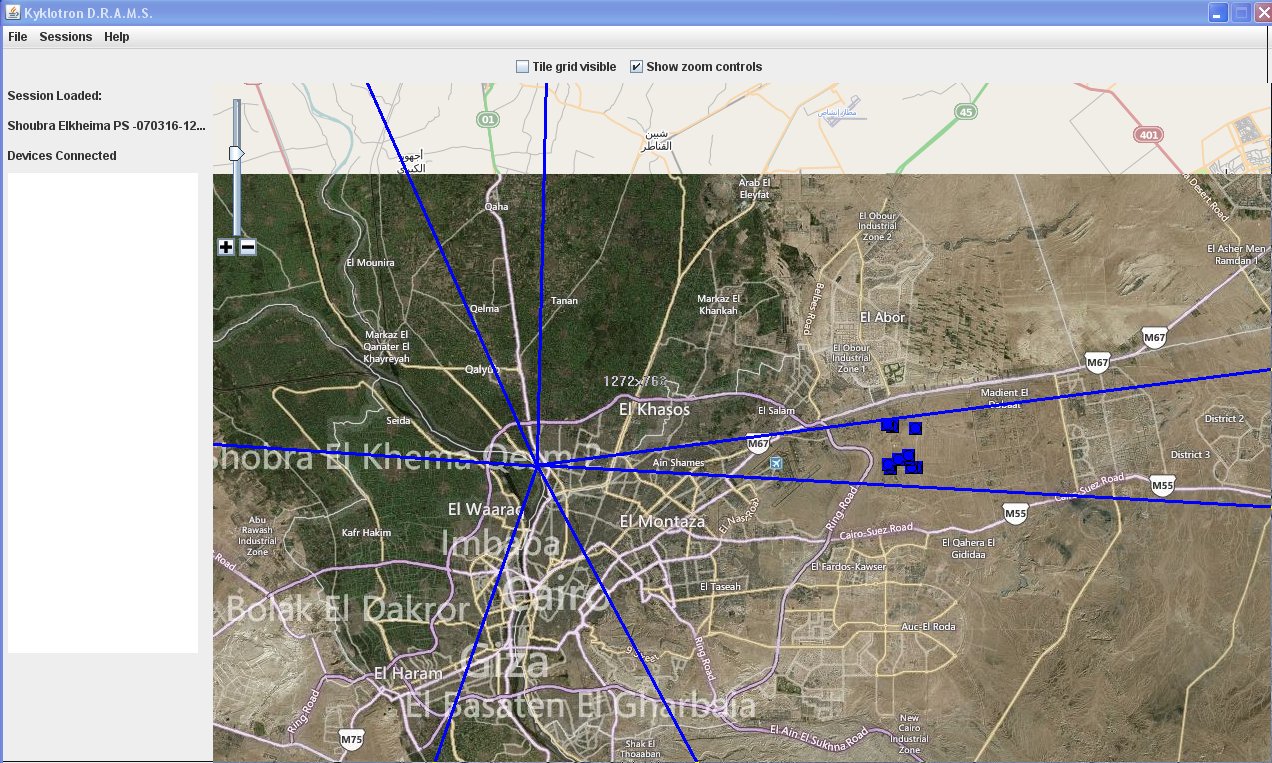
In the example at next picture two users (a,b) using ‘CBRN SAED’ systems located 4 targets (every crossing line is a possible target).' The exact point of located explosive on ground or surface of sea in real time recorded in a digital Geographical Information System (GIS) data base of the ‘CBRN SAED’ smart phone.
This digital tactical screen (known as ‘digital battlefield’) transmitted in real time ‘CBRN SAED’ system users using a GSM wireless 3G network (or other communication type) to a 'CBRN SAED' CONTROLLER computer installed in a command and control center, or other place (as in a vehicle) or a mobile command and control center.
This real time, tactical picture, can easily represent on a big screen of a command and control center , making 'CBRN SAED' a full C4ISR system.
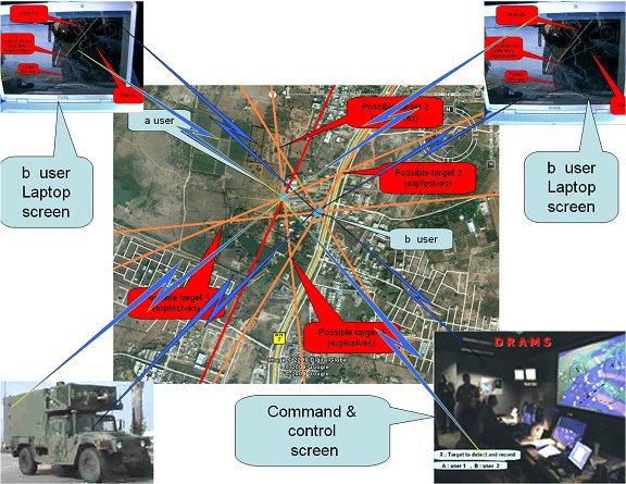
When using the 'CBRN SAED' system to detect C.B.R.N. threats it is not clear if a small quantity of explosive is detected near by or if a bigger quantity is detected further away. In order to detect that, different measurements have to be taken from different angles of detection. The points where at least 2 lines are crossing is where explosive is located.
The points where the measurements (Angles of Detection) will be taken, must be carefully chosen. Every Angle of Detection must be further examined from different locations, and from different angles of detection, in order to have at least 2 lines crossing. This way the location of the explosive is specified.
All these are better visualized, organized and planed with 'CBRN SAED' ltd’s 'CBRN SAED' environment while using the 'CBRN SAED' system. The 'CBRN SAED' system sends the Position of where the measurements are taken as well as the Angles of Detection to the 'CBRN SAED' CONTROLLER server.
The 'CBRN SAED' controller server plots on a map environment the Position of where the measurements are taken and the angles of Detection from that point. After taking measurements from different Positions, the locations where 2 or more lines are crossing are seen on the Map.

Every 'CBRN SAED' system is interfaced with a computer (smart phone), using embedded GPS (Global Positioning System) and embedded systems (Magnetometer and magnetic E-Compass). There is also a 'CBRN SAED' CONTROLLER server (laptop or tower, or desktop) for the C4ISR super user ('CBRN SAED' controller) that controls the 'CBRN SAED' system users available. 'CBRN SAED' systems communicates with the 'CBRN SAED' controller server. When a 'CBRN SAED' system detects explosive, then the Angle of Detection is sent to the 'CBRN SAED' Computer server through the communications channel. The communications channel can be selected to wireless GSM Connection. (CELLULAR NETWORK GSM 850/900/1800/1900 (FREQUENCY/BAND) UMTS 850/1900/2100, Band I, II & V).
Also available CONNECTIVITY Wi-Fi (802.11b/g), 3G and assisted GPS. The 'CBRN SAED' system (smart phone) which is located on the system, and has the GPS connected to it, plots the line from the current Position (given by the GPS) towards the angle of Detection sent by the compass of the system.
Compass Accuracy.
Compass is a system that is pointing out the Magnetic North Pole of the Earth. The Magnetic North Pole is different from the North Pole of the Earth. This difference varies with the Location on the Earth and with the Year. Also metals and magnets near the compass may change the reading of the compass. Metal buildings may totally change the reading of the compass. When the 'CBRN SAED' system detects explosive, then the Angle of Detection is sent from the compass of the System to the Computer through the communications channel. The communications channel can be selected to wireless GSM Connection. (CELLULAR NETWORK GSM 850/900/1800/1900 (FREQUENCY/BAND) UMTS 850/1900/2100, Band I, II & V).
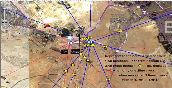
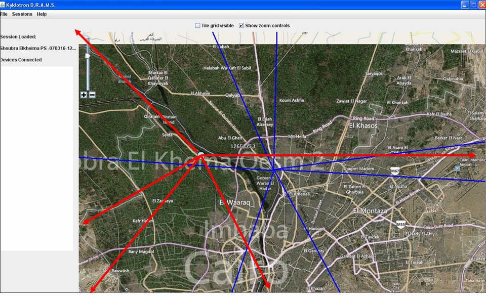
'CBRN SAED' Controller server screen (two users working, the red and the blue colored users )
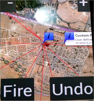
'CBRN SAED' user screen on 'CBRN SAED' SUPPORT SYSTEM (smart phone)

'CBRN SAED' screen (on the left) and 'CBRN SAED' user screen on 'CBRN SAED' SUPPORT SYSTEM (smart phone) (on the right)
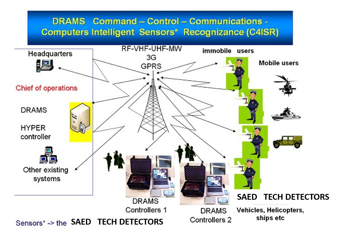
The 'CBRN SAED' ARCHTECTURE
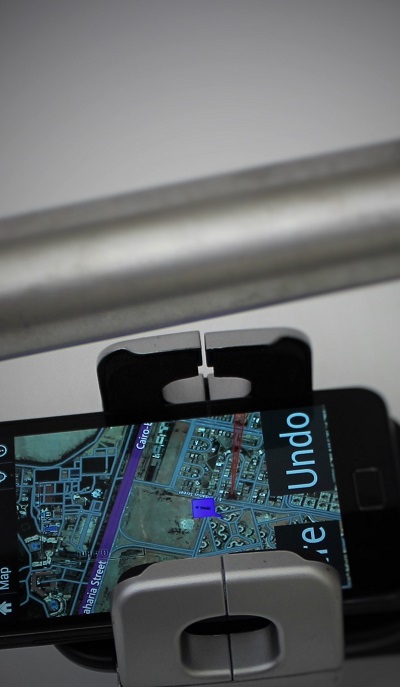
The CBRN SAED Support system (E3 ANDROID O.S. Application running on a smart phone)

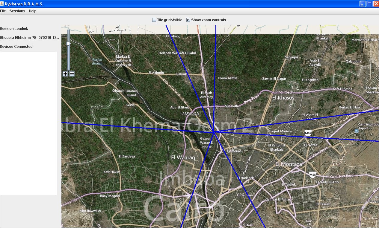
'CBRN SAED' screen in action. Two users scan the area. User 1 (Kyklotron_1 , blue line) & User 2 (Kyklotron_1 , red line). Target found when the red and the blue line are crossed. The cross point is the target area

'CBRN SAED' STRATEGIC INFORMATION GRID
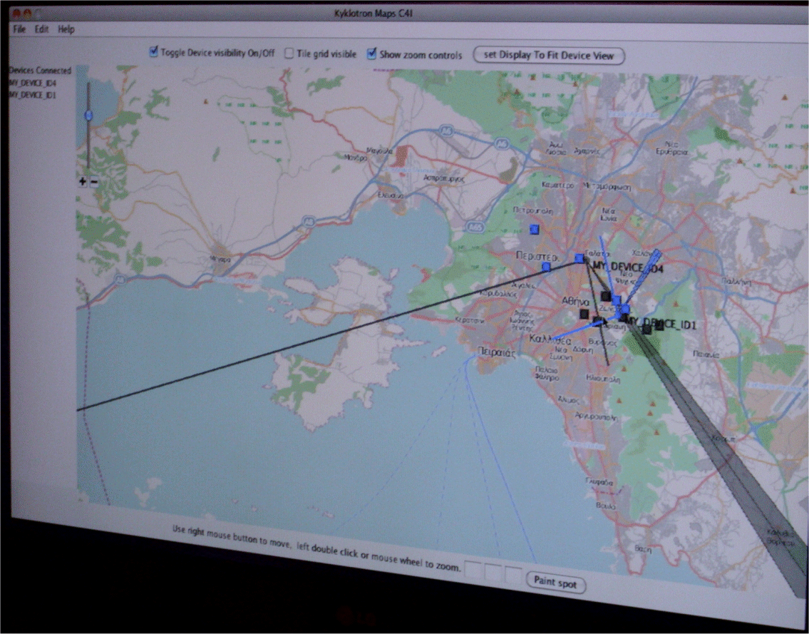
'CBRN SAED' screen in action. Two users scan the area. User 1 (MY_DEVICE_ID4 , black & gray lines) done 3 efforts. User 2 (MY_DEVICE_ID1 ,blue lines) done 3 efforts. Target found when the black and the blue line are crossed. The cross point is the target area
'CBRN SAED' is the ultimate tool for “cleaning” large areas fast. 'CBRN SAED' system sends to a Computer Map the direction and location where the C.B.R.N. threats or are located. Cosmetics, glycerin products, salts, metals and “dirty” environment do not influence the accuracy of C.B.R.N. threats detection. Electromagnetic transmission and radiation does not interfere and does not affect the operation and accuracy of the 'CBRN SAED' system.
'CBRN SAED' system is using a unique '3 Level Security' ltd C.B.R.N. threats localization PATENTED technology and method, the 'CBRN SAED'.
'CBRN SAED' based on the magnetic attraction (coupling) created by particular explosive structures when energized by low power electromagnetic waves, emitted by the 'CBRN SAED' system Magnetic Tuned Receptor .
Other C.B.R.N. threats detection systems although they promise to detect in long ranges are not accurate even in short distances. The systems that use high power ‘x’ and ‘γ‘ radiation, work only in very short distances, a few meters, and are actually “taking a picture” of the inside of a container or a luggage. Next chapter includes more information.


